
 |
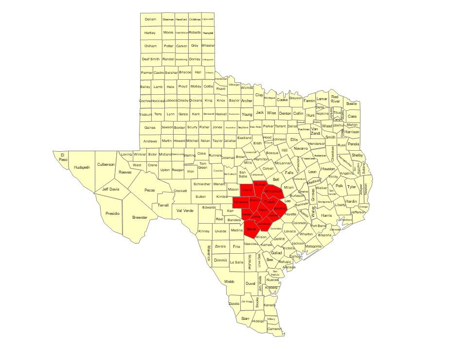
| ***WARNING*** The National Weather Service Has Issued a Red Flag Warning for: Bastrop,Bexar,Blanco,Burnet,Caldwell,Comal,Dimmit,Edwards,Fayette,Gillespie,Gonzales,Guadalupe,Hays,Kendall,Kinney,Lee,Llano,Maverick,Travis,Val Verde,Williamson,Wilson and Zavala Counties (A warning is issued when a hazardous weather or hydrologic event is occurring, imminent or likely. A warning means weather conditions pose a threat to life or property. People in the path of the storm need to take protective action.) |
 |
| Increased Fire Danger Continues Across South Central Texas… .A combination of critically to extremely dry fuels, breezy winds, and low afternoon humidity continue to support wildfires with high resistance to control, per guidance from the Texas A&M Forest Service. It is also being observed that in this very hot air mass relatively light prevailing winds are routinely gusting to more than double the value of the sustained speeds, reaching between 25 and 30 MPH in the late afternoon and early evening hours. Based on these observed conditions and impacts, a Red Flag Warning is in effect Monday and Tuesday afternoon and evening for much of South Central Texas. Elevated to near critical fire weather conditions are expected for the remainder of South Central Texas where a Fire Danger Statement will be in effect. RED FLAG WARNING REMAINS IN EFFECT UNTIL 11 PM CDT THIS EVENING FOR WIND AND LOW RELATIVE HUMIDITY FOR THE EASTERN AND WESTERN PARTS OF SOUTH CENTRAL TEXAS… RED FLAG WARNING IN EFFECT FROM NOON TO 11 PM CDT TUESDAY FOR WIND AND LOW RELATIVE HUMIDITY FOR THE EASTERN AND WESTERN PARTS OF SOUTH CENTRAL TEXAS… The National Weather Service in Austin/San Antonio has issued a Red Flag Warning for wind and low relative humidity, which is in effect from noon to 11 PM CDT Tuesday. * WINDS…South 10 to 20 mph with gusts up to 30 mph. * RELATIVE HUMIDITY…As low as 19 percent. * IMPACTS…Any fires that develop can spread rapidly and exhibit high resistance to control. Any outdoor activity that could produce flames or sparks is discouraged. PRECAUTIONARY/PREPAREDNESS ACTIONS… A Red Flag Warning means that critical fire weather conditions are either occurring now….or will shortly. A combination of strong winds…low relative humidity…and warm temperatures can contribute to extreme fire behavior. |